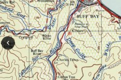
Map
Photos
Event Description
Dear Hashers, Come now, before the drought reaches Jamaica!
Hash 563 starts from the River Edge camping/bed & breakfast lodging complex. We’ve Hashed from here in 2012 and 2015. The location is right next to the Pecar river and set in the foothills of the Blue Mountains. This trail is about 6km, we cross rivers three times (shallow, ankle deep), and use old road, quiet road, forest path and in one section just forest! See the montage – all as of 7 August.
It is a lovely setting, and the river is there for after. There will be a Hash meal available, for those who register for a meal. Mrs Chuck, who runs the place, really does need the numbers by Thursday 11th.
Hash Details
Mrs Chuck will be organising the meal. Will be chicken, rice & peas, vegetables, I think some salad too. There will be a vegetarian dish too.
$700 JA
Clueless Sherlock,
Hash Directions
Ok Hashers read carefully. You first need to get to Annotto Bay, which you all know is on the north side of the Island. (You’ve all be been there! ) You take the road up to Stony Hill, down to Golden Spring and stay on the main road (passing through Castleton and the cardboard policeman with a radar gun!). When you reach the north side you come to the Robert Schuman roundabout. You turn RIGHT at the roundabout and go to Annotto Bay. NB.NB. The Junction road is SLOW and the first part in a poor condition. Give yourself plenty of time to reach and drive carefully. From here, the 2nd stage of trip, it is just 6.43km to the River Edge location where you park. Just keep on the Fort George road. You'll pass a large ‘Fort George’ sign at farm building on right. At about 3km the road bends to left and you cross a road bridge over the river. (Bucket river or Annotto Bay river) Over the bridge turn LEFT. (Only way). About 300yds further on there is a LEFT turn down a track road. Take the left turn. There will be a JAH3 sign here. Drive slow and carefully. River Edge complex is 700m further along this track. Ample parking is within the grounds. If in doubt just stop and ask. Everyone will know where River Edge is. Journey time from Manor Park – about 1hr 30/45mins See this Google pin for location.https://maps.app.goo.gl/YHvt4oZKjchqqb4P9
When you reach Annotto Bay and the main street, you turn 1st RIGHT on to Fort George Road (There is a road sign there and laundry on the corner)
NB. This road is level, but very pot holed in places. But all driveable. However, the last 700metres, before you reach the location is a poor track road. Low lying vehicles will not be happy!
Once over bridge, you are in Fort George Sq. You’ll see a sign.
The road bends to the right. About 300yds further along the road comes to a Y junction. Take RIGHT road, which drops down a little.
Do not take the left fork, which rises up hill.
Just keep going on same road. You’ll pass a pair of green painted stone gate pillars on your right side.
Just a little ahead there is another Y junction, with a large rock between the two roads. Take the RIGHT fork and cross a small fording, may have some water in it. Some 150yds ahead road bears right to cross the river. This is the new concrete bridge which crosses the Pecar river. Do not attempt to cross the old metal and wood bridge!!
Hash Extras
We do cross shallow rivers. Twice, maybe three times. You will almost certainly get wet feet! Bring mosquito spray - the forest is a little bitey. One steepish forest hill, but not long, and not like recent ones. Bring your swim wear and towels for river, if wish after.
August 10, 2022
876 878 0270 Hash Master
Visited 453 times, 2 Visits today


