Map
Photos
Event Description
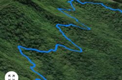
This is a fine and relatively easy trail along a section of the Hog Hole river valley, and part of the, now abandoned, parochial road which used to traverse from Craig Mill to Guava Ridge. The first kilometre, from Violet Bank, is along the (quiet) driving road above the river valley, with wide views of the valley. It then descends an old track which trails above and beside the Hog Hole river system and along a farmer’s pathway. We pass the remains of a 19th century coffee pulpery, now overgrown in the forest growth.
A trail is only 4.6 kilometres. Whilst not steep, it does involve some up and downs!, (come on!) and it’s occasionally narrow. The last section is directly down to the Hog Hole river, which has to be trailed along for a few hundred yards. The river is low at present.
Hash Details
There will be food. Cooked by community. Jerk chicken and/or curried goat, with potato salad, rice and peas. NB. Prices have risen in the past 2 years. We're not getting food at $400/$500 a meal. PLEASE Register is wishing food.
$1000.00 JA
Clueless Sherlock, Never Screams, Girly Bitz
Hash Directions
NB. Please let us all get there on time, even try for early?! To note: - if you do not Register I cannot know of your attendance and we cannot be waiting for Hashers who I do not know are attending! If, having registered, you are unable to attend or running late please contact me. How to get there: Violet Bank is a small rural community which sits atop a ridge, off the main driving road which runs from Gordon Town to Guava Ridge. It does not have a community road sign. There will be a JAH3 sign at the location. It takes about 30 minutes from Gordon Town. Drive to Gordon Town from Papine (about 10 minutes). At Gordon Town you turn RIGHT over the bridge at Gordon Town, just before the police station. It is a 30/35 minute drive from Gordon Town. Once over the bridge at Gordon Town you stay on the main road all the way to Violet Bank - you do not turn off anywhere! The road is narrow, so drive with care. At 3km you will pass over a small landslip section on the main road. Single lane travel only. About 200m further on you will then reach Craig Mill (no community name marker) which is on a sharp right hand hairpin bend. You will see spring water flowing from a high embankment wall on your right side, and then flowing from the left, as you turn sharply back in yourself. Continue all way up hill, and you will eventually pass/cross over the newly constructed road bridge (about 5.85km from Gordon Town). This crosses the George's river. The crossing is now a large wide turning area on a sharp left turn bend. Less than 1km further up hill is Violet Bank. There will be a JAH3 sign. PARKING. Parking is limited/tight, so please consider car sharing. Please park up along the side of the road. Local community will assist in directing. Be prepared to walk a little from your car to Hash circle! The Hash Circle meeting point will be down the rough narrow road (All JAH3 sign-posted) which runs down and to the Left of the main road. There is a bar and yard where we will meet.
Hash Extras
This is not a long trail, but does require a level of 'sure footedness', but otherwise quite easy and very enjoyable. NB. It’s not a 4km on the flat round the Hermitage dam! This old parochial road now suffers from land slip in sections, but was, in living memory, a substantive road carrying traffic. Old maps still show the route before the main driving road which is now used. (The attached map is from 1927 and shows the old road. The current driving road was cut much later.) The trail avoids all major landslip sections, and some sections have been re-cut just for you! The last part of trail diverts down to the low running Hog Hole river, to avoid major landslip, before hiking back up 100ft to Violet Bank.
June 15, 2022
876 878 0270 Hash Master
Visited 417 times, 2 Visits today


