Map
Photos
Event Description
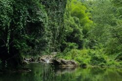
A Hash across and through the land of a Hare. Very rural farmland and forest. Crossing of stream(s) involved. About 5km
Hash Details
Local Curry Chicken OR Jerk Pork. Rice & Peas. Local farmed Coconut water
$600JA
Dry Spell + Norman Mattison
Hash Directions
Directions summary: The Hash is on Norman’s farm (One of the Hares). Journey time: about 1hr 45 min. Journey time from from Cool Oasis, just east of Tower Isle, on the North Coast Highway, it is 25 minutes to Gayle, St. Mary, then another 10 minutes to Wood Park. Donnington. Directions detail: See this Google pin/map reference for location and.
NB. Advice. Travel to north side of the Island, to Ocho Rios, and reach from north coast.
Yes, you can reach location on rural, via Linstead, on what are, in place very poor roads.
The journey is a beautiful drive along a road framed in bamboo and wiss.
These directions are from the north coast highway side.
• Drive to Ocho Rios on the new Highway 2000 toll road (or take the old Mount Rosser route, or via Stony Hill route) to get to north side of the Island.
• From Ocho Rios, turn RIGHT and drive along the main north coast highway, for about 5 miles.
• Drive past Couples at Tower Isle. Turn RIGHT, off the main road, and before the start of the hill, at the road sign for Retreat. (The Cool Oasis gas station is on your left. NB. The petrol station is where we turned left, to go reach Sugar Pot Ruins at 2018 Hash Olympics).
• Pass the Retreat Training Centre and go through Retreat.
• After an old stone church, turn RIGHT at the T junction. (Not left!, which is a board bridge.)
• Go through Bamboo Walk.
• Go through Stewart Mountain and Governor's Pen. NB. The road is briefly bad, hairpin and narrow. Blow your horn to warn other vehicles you're coming.
• On reaching Gayle, pass the transport centre. Keep LEFT at the Texaco. You'll encounter pot holes.
• Turn right at the next junction, which is surrounded by fields. More potholes, and straight through to Barclaytown (TJ's Hardware).
• Ten minutes later, go through Wood Park. Pass the first bridge. Go around the bend, then go left over the iron bridge on Donnington Road.
• Pass Donnington Primary School on left. Keep straight (not right) at a blue shop and look for the blue and orange house in the photo. There is parking in the yard.
Hash Extras
The Hash is on the land of Hare Norman. You will get wet feet on trail. We cross ankle deep stream(s). Change of socks and shoes advised. Insect repellent also advised. 5km distance
March 27, 2019
Norman: 876 466 9788
Visited 369 times, 2 Visits today


